Wednesday, June 26, 2019
THE RIDE HOME AND 2 SMILES
I was up in the morning. I packed up leisurely. Enid fed me up first class. There was nothing left to do but give my two great hosts a hug, and hit the road which I did at about 9:30. This was in July. I knew that the hot desert was out there waiting for me......
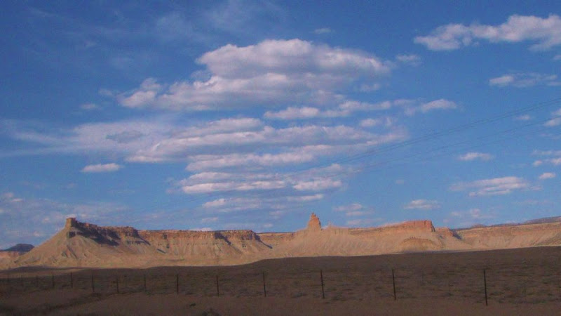
I traveled west, back up the La Sal creek road, past the Cashin Copper mine road. Speaking again about the Cashin Copper Mine[URL="http://ontheroadwiththesagrillos.blogspot.com/2008/04/atv-ride-to-cashin-mine.html"][/URL], check it out. It's worth copy and pasting that URL into your browser to view the Cashin Mine.
I had one other Indian destination that I'd like to check out on the way home. About 25 miles south of Tuba City there's another Indian Village on top of a 500 ft high mesa called Tewa or something like that. It's not on my AAA Indian Country map.
It seems like the Indians of the area (Navajo Nation) have been betrayed by the white man in the mental perception department. The tendency is for gringos to view the Indians and their culture, over the years and then, denigrate their ways.
It's resulted in the Indians keeping to themselves even more, and when they do allow people to view there ways it's in a controlled guided tour and quite often there are no pictures allowed.
It's that way at Tewa. I went on a tour at First Mesa which is 15 miles away and is a similar village. The guide pointed out Tewa, which could hardly be seen cross the lower mesa between, as we walked on her tour. So I wanted to see it. I'd like to do that on the ride home.
The trouble was that the weather report spoke of a hot front moving in. In fact, it spoke of 115 degrees at The Colorado River at Needles Ca. I didn't know how that would translate to temps at Tuba City a few hundred miles from Paradox.
So I figured to make the decision about Tewa when I got to Tuba City. Well, at TC, it was a hundred degrees with the sun blazing down. I decided to save Tewa for another trip and make a Beeline to the higher elevation of Flagstaff.
In TC I broke out my cool vest. Those things are fantastic at making a hot day tolerable. Still, I preferred not to linger in hot country.
It's 4000 ft at Tuba City and 7000 at Flag. The climb put a little extra stain on my Sabre. On the steeper climbs going toward Flag, I noticed a different exhaust note and a slight loss of power.
At first I wondered if I was imagining things, but further incidences confirmed that I was losing a cylinder on the longer climbs....Hummmm.... Slowing 20mph would bring the cyl back though.
I concluded that I had a fuel flow problem (probably fuel filter),and decided to go with it as I could usually maintain 60mph. From Flagstaff it would be all downhill to sea level at home with only a few climbs.
I breathed a sigh of relief at Flagstaff. I even found the right turn to get to I-40 without going through Flag's downtown. Ok, now downhill to Kingman.
I saw some news At the Micky Ds in Tuba City that said it was indeed 115 degrees at Needles at the river. I didn't want to deal with that today so I decided to hold up in Kingman for the night.
There were more uphills sections in the ride to Kingman than I remembered. I resorted to taking advantage of the draft from trucks to help me up the hills. In retrospect I should have found an auto parts store in Flagstaff, and replaced the fuel filter with something generic.
I didn't want to deal with stripping the bike down in the heat, plus I didn't think I'd have such a struggle keeping my speed up going down to Kingman.
I checked into my favorite Motel at Rt 66 in Kingman, the 1st Value Inn, for $29 with Wifi. I decided to get to sleep early and leave at 2-3 am.
That worked well as the temps were probably only 100 at the river, but my bike suffered with the strain of the 2000 ft, 15 mile long climb going west from Needles. In fact keeping my speed near 60 was a problem even using drafting when I could. A couple times when I'd start dropping that Cylinder it got so bad that I'd be on the shoulder as low as 25 mph before the fuel level in the carbs would come back. then I'd nurse it along till I could get in a truck's draft again.
It seemed like a long ride to Barstow. In reality I only lost 15 or 20 minutes, but time goes real slow when your having trouble
I took a break in Barstow and had a coffee with a burger at the junction to I-15 south. Back on the road, I could tell immediately that the 30 Degree angle change of travel to a more southerly direction helped with a little less headwind.
I only had one more episode with the lack of fuel on the last 150 miles home.
I walked in the door at 10am to be greeted with a hug as if I were a returning conqueror .......and to make the moment even better my 4 yr old GGD was there as well. Those 2 smiles made my return a holiday ......
It was good to be home......though I'd left a few things unseen. I hope to get back out there in the near future...........we'll see.
THE LA SAL MOUNTAINS
After the Harvest We took off for a ride over the La Sals. Glenn stoked up his Jeep pre-runner, and up the hill we went.
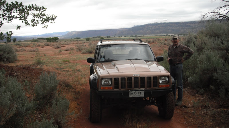 |
| From Glenn Case's spread |
 |
| From Riding SM4C, Sabmag |
Just look at that mountain...Beale mtn of the La Sal mtns, over 12000 ft (I think).
 |
| From Riding SM4C, Sabmag |
Getting closer
 |
| From Riding SM4C, Sabmag |
We stopped by to look at Geyser Lake as it's a part of their irrigation system. The check valve was hopelessly clogged with winter storm debris. Glenn figured this would take a backhoe to fix.
Buddy had fun just the same.... He's a mtn dog, no little sticks for him :freaky
 |
| From Riding SM4C, Sabmag |
If that small landslide gets any bigger it might take the road, up there on top, with it.
 |
| From Riding SM4C, Sabmag |
We traveled around the Mtn on the east side. Our route went to nearly 9000 ft whereas the peak is at 12800. The valley at Paradox is routinely a 100 degrees or so during summer. The locals all have a vacation trailer or cabin up the hill for heat relief. It's their style of air conditioning. Works for them....and the beauty of the mtn is good mental therapy as well. :clap
 |
| From Riding SM4C, Sabmag |
The Cocopelli trail went down there in that valley. I'd been there on my DS bike a few years ago.
 |
| From Riding SM4C, Sabmag |
Further on we approached Castle valley on the north side of the La Sals.
 |
| From Riding SM4C, Sabmag |
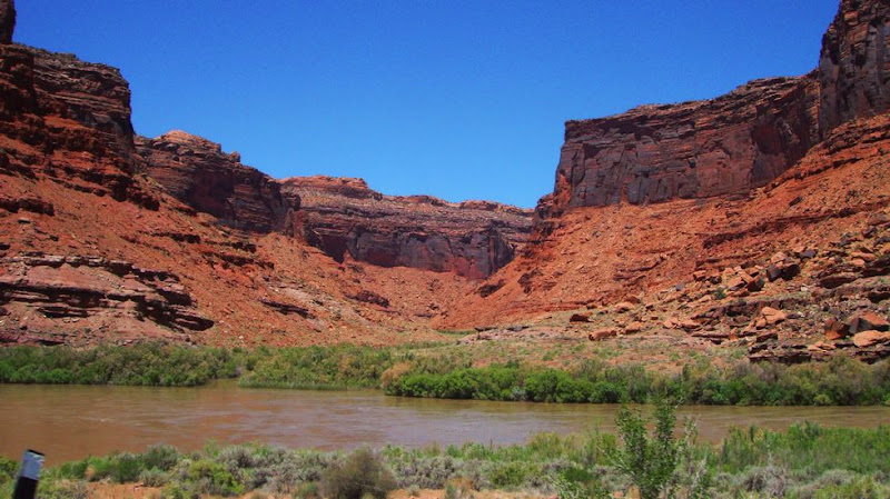
There are some great red cliffs there bordering the Co River before the river gets to Moab.
 |
| From Riding SM4C, Sabmag |
 |
| From Riding SM4C, Sabmag |
 |
| From Riding SM4C, Sabmag |
Eventually we reached the Co River. I'd never seen it so high. Nearer to Moab it was over parts of the bike path along the river.
 |
| From Riding SM4C, Sabmag |
We finished the day off with lunch at Micky D's. I'm a big spender so I bought. :rofl
We rode back through old La Sal. They pointed out the old building where Enid's GGD started his store back in the 1880's. They pointed out the road to the defunct Cashan Copper mine. These are all places that I have to go see, but not this trip.
I reckon I'll have to make at least one more trip to visit Glenn and Enid.
Note: A couple years after this trip, I did go see the Cashan Copper mine. You'd definitely need a higher clearance bike to go see it. Very interesting, though.
PARADOX, CO AND THE CASE RANCH
The couple days riding with the boys was fun. Everyone packed up and left Sunday morning. I took off toward Teluride as did Matt, Ryder, and DeWayne.
.....the last I saw of Matt.... Thanks for getting us all together.
 |
| From Riding SM4C, Sabmag |
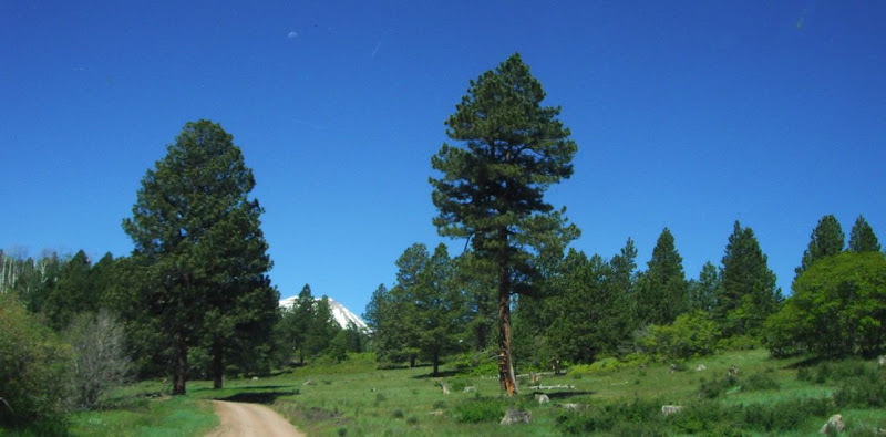
The ride toward Teluride was majestic for sure, and took me to 10000 ft again.
 |
| From Riding SM4C, Sabmag |
 |
| From Riding SM4C, Sabmag |
Rico is a pretty little town along there somewhere. This was June 21st and it should have been prime time tourist season, but Rico was suffering from the recession like everywhere else.
 |
| From Riding SM4C, Sabmag |
 |
| From Riding SM4C, Sabmag |
 |
| From Riding SM4C, Sabmag |
My ride bypassed Teluride. I was headed toward Norway and Naturita, and Nucla. The last 2 towns were named for the urainium boom here in the '50s. I don't know what put a halt to uranium mining around these parts, but there are towns like Uravan just down the road that are completely gone.
 |
| From Riding SM4C, Sabmag |
I picked up a bike behind me. I moved over and waved him by....
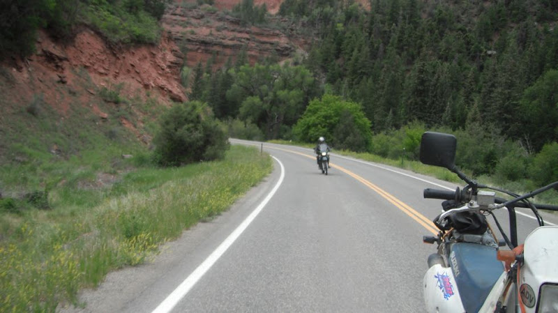 |
| From Riding SM4C, Sabmag |
....I noticed as I was traveling along the Delores River once more a little south of the Norway hill.....I was getting hungry.
 |
| From Riding SM4C, Sabmag |
I pull into Bear boat launch area. I should have been a little more cautious. I saw a car down in there, but it didn't register that he was getting ready to come out the steep entrance, and that he probably didn't see me.
As I pulled in he was making a little run at his exit hill. There really wasn't room for 2 vehicles to pass. No way was I able to back up. He pulled over as far as he dared, and I was able to squeeze by.
It was squeeky, and with just a little more caution on my part it could all have been avoided.....but what the hell, that's what makes it an adventure, right.
 |
| From Riding SM4C, Sabmag |
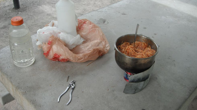
I got a stove out and heated up last nights spaghetti. I sat by the stream and looked for a raft or something to come by. Nothing but one duck came floating by. He looked like he was having a ball with the river all to himself. BTW, those pliers make an excellent pot holder....and have a 100 other daily uses.
 |
| From Riding SM4C, Sabmag |
Finally I make it to Paradox Valley. My goal Is Glenn Case's ranch still some 20 miles away.
 |
| From Riding SM4C, Sabmag |
I spent three days with Glenn learning how to ranch a hay farm. Glenn's wife, Enid, has roots in this valley that go back to 1880. Her great GrabdFather came here from the Ca gold rush. It is said that he had asked a mtn man where he should go as he wasn't making it in Ca. The man told him that Paradox valley was the most beautiful place that he'd ever seen. I tend to agree....
 |
| From Glenn Case's spread |
Or
 |
| From Riding SM4C, Sabmag |
The trouble with the valley was water. The nearby La Sal Mtns had plenty of snow pack to supply water through the summer growing season, but it needed to be managed. So back in 1890, the ranchers got together and hired a man with a team of horses and a drag bucket to dig this ditch for 5 miles along the upper side of the valley for irrigation. It's been doing it's job ever since.
 |
| From Glenn Case's spread |
Glenn seemed very relaxed in the last picture, but I followed him for 2 days as he managed his 2 rolling irrigation lines. It was fun for me, but it was frustrating as well with all the things that went wrong that would stop the watering.
 |
| From Glenn Case's spread |
Glen had finished bailing the hay the day that I arrived, but he still had to get rid of the hay before anything bad happened to it. It's a liability until it's sold and off the property.
Glenn had 65 bales of hay, ea 15000 lbs, out there at $120 dollars a bail. He gets three cutting a year. The first cutting goes for his hay making expenses. The next 2 are his profit.
He makes a small fortune there, by starting out with a big fortune. :freaky:freaky
We moved hay and worked on the sprinklers for 2 days before we could take a day off. Don't get me wrong, this wasn't work for me, I was just playing with new bigger toys. I had a blast.
 |
| From Glenn Case's spread |
Enid took good care of me. I didn't get any breakfasts like this on the trail....
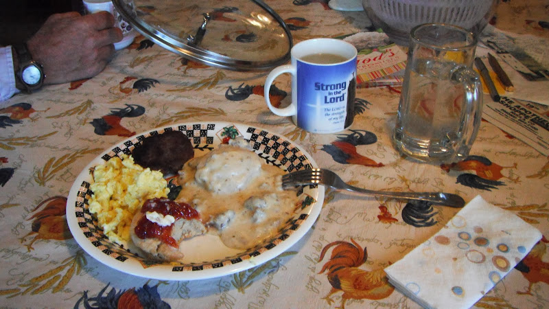 |
| From Glenn Case's spread |
I don't want to bore you with ranching...After the hay was finished, Glenn and Enid and Buddy took me for a ride over the La Sal mtns.....
NEEDLES OVERLOOK
Day 2 at Dolores would be spent riding with the boys, and girl. I was really enjoying a couple days of riding with no trailer.
We had one big KTM and an SV1000 ridden by Ye Wilde Ryder, and His wife Lynn. This couple has been riding big bikes fast together for years. She hangs off his 6 about 20 feet and to the side. They've been doing this for the 10 years that I've known them. She is there like glue and he knows she's there. They are a great team.
Then there were the 4 boy down from the Denver area. One of those 4, Dave Ryder, was from Pittsburgh On a borrowed 1250 Bandit thanks to Matt Mcdonald. Matt rode his Long trusted '83 700 Magna for this week.
Actually, Matt Mcdonald and DeWayne organized this little get-together. Don Goldston was along just for the joy of riding on his newish FJRand he was a long time member of this group.
First we tried out Karla's for breakfast. Turned out to be kinda self serve style. They had three topping that they put on everything. Sausage gravy, Green Mx Chilly sauce, and Mx red chilly sauce. It was great. https://goo.gl/maps/tnXmLN5Tm3vq9RBh7
Ye Wilde Ryder and Lynn
After breakfast Ye attempts a parking lot wheelie to set the ride's tempo. :clap :clap
....and partner Lynn
DeWayne on his very nice Honda liter bike.
Dave Ryder on the Bandit
Don Goldston on the FJR...
Dave had his V1 radar detector with him. It seemed like a good Idea for him to ride point as we would be pressing the speed limit out there in the wide open spaces. The trouble with that was that Dave didn't know where he was going.
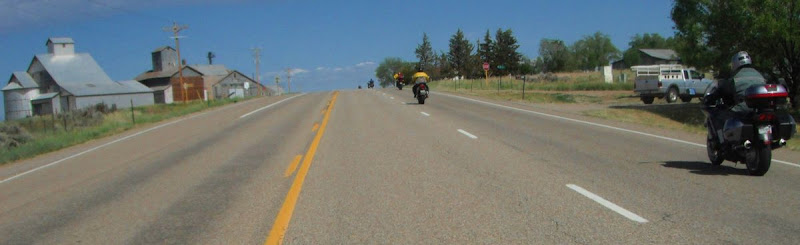
After some starting and farting, it became clear to me that I was the only one that had been to all the places that we were going to go today, so I took the lead and showed the way. Later I dropped back for a few pics.
...somewhere around Dove Creek on 491.
I love this shot with the crop duster...
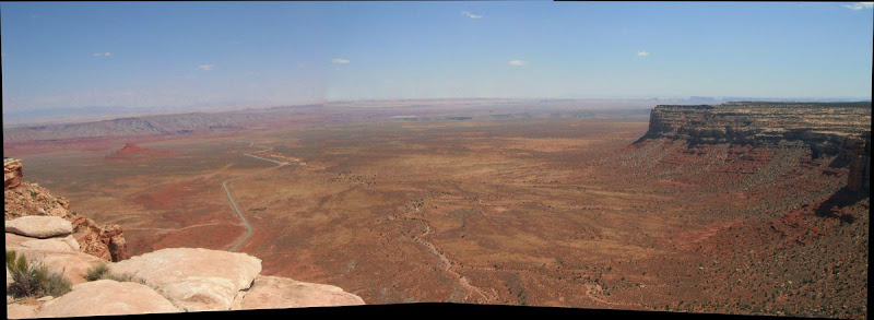
We passed Church Rock signifying 6 miles to the Needles Overlook road. Someone hollowed out the rock for some reason and gave the rock a name. That's a great looking rock...nearly symmetrical.
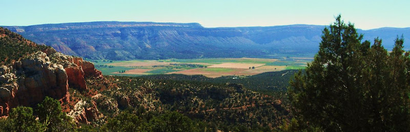
It was only another 25 miles to our destination. The red cliffs would soon begin.
Looking behind us across the plateau is the majestic La Sal Mtns boasting Mt Beale as it highest peak.
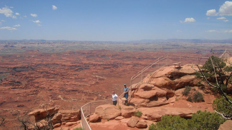
We arrived at the Overlook parking area...
The first order of business was to pick up Don's FJR. His foot had slipped on the pea gravel and done a slow speed drop as he was backing in. Damage was a foot peg. Don easily replaced it with a passenger peg.
The Needles Overlook looked out at the Co River as it snaked past, and the Needles Outpost that I'd been to yesterday. Believe me, it was a completely different view from up here.
That's the Co River snaking along out there......
Ye, DeWayne, Lynn and Dave
We spent an hr out there walking all over the place....it was worth the visit.
Matt and Dave......
It wasn't easy to get the whole group together....and look at that sky, just f'n beautiful.
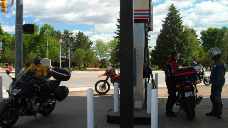
Then we move on to Blanding where we gassed up and had a bit of fast food for lunch.
......... NEXT THE MOKI DUGWAY..........
View Larger Map
Having gassed in Monticello, not Blanding, we all discussed how far it was to Moki and then Mexican Hat for gas. It was important because Matt's Magna was only good for 120 miles or so.
I figured it was a little over a 100 miles. It was easy for me to say as I wasn't the one that would run out. :evil But Matt took my word for it. I don't know if I'd have done that.
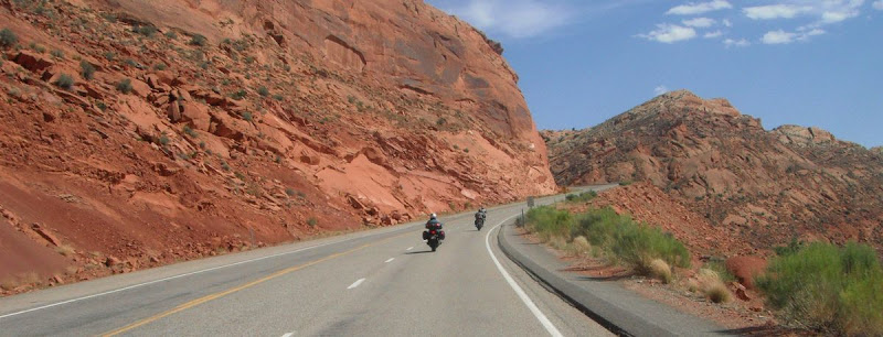
So we lit out down 191 to 95 east and then 261 South to the MD. There are some vast landscapes, gaps and cuts through cliff, and curvy roads on the way. The Dugway was about 90 miles away, and some pretty good riding if I do say so myself.
All this was out there....look at that little dirt road over there....
Recapture lake, I think, south of Monticello.
Finally we arrived at the 2000 ft cliff that is the reason for the Moki Dugway. Copied from a net search: >Indians had long had trails up to the top of Cedar Mesa. Then in 1958, Texas Zinc, a mining company, built the Moki Dugway, in its current form, so they could carry uranium ore from the Happy Jack Mine in Fry Canyon, Utah to a processing mill in Mexican Hat. The Moki Dugway descends 1,100 feet in 3 miles. It is the slowest 3 miles you will ever drive.<
Ye was the the only one capable to drive to the edge.
Does that look like only 1100 ft to you?
Finally a picture of Matt's 700. It was a sweet looking Magna, but lately it had begun to slip out of second gear and leak oil from behind the clutch slave cylinder.
It was getting late and we had another 100 plus miles to go, so we rode on into Mexican Hat and had something to drink. Some shed a layer as it was closer to a 100 down at the new lower altitude.
From there, It was pretty much 'make Jet' for the ride back to camp....but there were still things to see.
Lynn and Ye stopped in Cortez to get the making for a spaghetti dinner for everyone. That was beyond the call of duty, for sure.
They had a room at the RV park with pots and pans so we all took advantage of that, and chowed down heartily. We had a few beers afterward, but everyone was tired, and went to bed early. It had been a long day.
There were a lot of leftovers so I bagged it up for tomorrow.....remember there are lots of starving kids all over the world, and it's bad to be wasteful. :evil:evil
We had one big KTM and an SV1000 ridden by Ye Wilde Ryder, and His wife Lynn. This couple has been riding big bikes fast together for years. She hangs off his 6 about 20 feet and to the side. They've been doing this for the 10 years that I've known them. She is there like glue and he knows she's there. They are a great team.
Then there were the 4 boy down from the Denver area. One of those 4, Dave Ryder, was from Pittsburgh On a borrowed 1250 Bandit thanks to Matt Mcdonald. Matt rode his Long trusted '83 700 Magna for this week.
Actually, Matt Mcdonald and DeWayne organized this little get-together. Don Goldston was along just for the joy of riding on his newish FJRand he was a long time member of this group.
First we tried out Karla's for breakfast. Turned out to be kinda self serve style. They had three topping that they put on everything. Sausage gravy, Green Mx Chilly sauce, and Mx red chilly sauce. It was great. https://goo.gl/maps/tnXmLN5Tm3vq9RBh7
 |
| From Riding SM4C, Sabmag |
 |
| From Riding SM4C, Sabmag |
Ye Wilde Ryder and Lynn
 |
| From Riding SM4C, Sabmag |
After breakfast Ye attempts a parking lot wheelie to set the ride's tempo. :clap :clap
 |
| From Riding SM4C, Sabmag |
....and partner Lynn
 |
| From Riding SM4C, Sabmag |
DeWayne on his very nice Honda liter bike.
 |
| From Riding SM4C, Sabmag |
Dave Ryder on the Bandit
 |
| From Riding SM4C, Sabmag |
Don Goldston on the FJR...
 |
| From Riding SM4C, Sabmag |
Dave had his V1 radar detector with him. It seemed like a good Idea for him to ride point as we would be pressing the speed limit out there in the wide open spaces. The trouble with that was that Dave didn't know where he was going.
After some starting and farting, it became clear to me that I was the only one that had been to all the places that we were going to go today, so I took the lead and showed the way. Later I dropped back for a few pics.
...somewhere around Dove Creek on 491.
 |
| From Riding SM4C, Sabmag |
I love this shot with the crop duster...
 |
| From Riding SM4C, Sabmag |
We passed Church Rock signifying 6 miles to the Needles Overlook road. Someone hollowed out the rock for some reason and gave the rock a name. That's a great looking rock...nearly symmetrical.
 |
| From Riding SM4C, Sabmag |
It was only another 25 miles to our destination. The red cliffs would soon begin.
 |
| From Riding SM4C, Sabmag |
 |
| From Riding SM4C, Sabmag |
Looking behind us across the plateau is the majestic La Sal Mtns boasting Mt Beale as it highest peak.
 |
| From Riding SM4C, Sabmag |
We arrived at the Overlook parking area...
 |
| From Riding SM4C, Sabmag |
The first order of business was to pick up Don's FJR. His foot had slipped on the pea gravel and done a slow speed drop as he was backing in. Damage was a foot peg. Don easily replaced it with a passenger peg.
 |
| From Riding SM4C, Sabmag |
The Needles Overlook looked out at the Co River as it snaked past, and the Needles Outpost that I'd been to yesterday. Believe me, it was a completely different view from up here.
 |
| From Riding SM4C, Sabmag |
That's the Co River snaking along out there......
 |
| From Riding SM4C, Sabmag |
Ye, DeWayne, Lynn and Dave
 |
| From Riding SM4C, Sabmag |
We spent an hr out there walking all over the place....it was worth the visit.
Matt and Dave......
 |
| From Riding SM4C, Sabmag |
 |
| From Riding SM4C, Sabmag |
 |
| From Riding SM4C, Sabmag |
 |
| From Riding SM4C, Sabmag |
It wasn't easy to get the whole group together....and look at that sky, just f'n beautiful.
 |
| From Riding SM4C, Sabmag |
Then we move on to Blanding where we gassed up and had a bit of fast food for lunch.
 |
| From Riding SM4C, Sabmag |
......... NEXT THE MOKI DUGWAY..........
View Larger Map
Having gassed in Monticello, not Blanding, we all discussed how far it was to Moki and then Mexican Hat for gas. It was important because Matt's Magna was only good for 120 miles or so.
I figured it was a little over a 100 miles. It was easy for me to say as I wasn't the one that would run out. :evil But Matt took my word for it. I don't know if I'd have done that.
So we lit out down 191 to 95 east and then 261 South to the MD. There are some vast landscapes, gaps and cuts through cliff, and curvy roads on the way. The Dugway was about 90 miles away, and some pretty good riding if I do say so myself.
All this was out there....look at that little dirt road over there....
 |
| From Riding SM4C, Sabmag |
Recapture lake, I think, south of Monticello.
 |
| From Riding SM4C, Sabmag |
 |
| From Riding SM4C, Sabmag |
Finally we arrived at the 2000 ft cliff that is the reason for the Moki Dugway. Copied from a net search: >Indians had long had trails up to the top of Cedar Mesa. Then in 1958, Texas Zinc, a mining company, built the Moki Dugway, in its current form, so they could carry uranium ore from the Happy Jack Mine in Fry Canyon, Utah to a processing mill in Mexican Hat. The Moki Dugway descends 1,100 feet in 3 miles. It is the slowest 3 miles you will ever drive.<
Ye was the the only one capable to drive to the edge.
 |
| From Riding SM4C, Sabmag |
Does that look like only 1100 ft to you?
 |
| From Riding SM4C, Sabmag |
 |
| From Riding SM4C, Sabmag |
 |
| From Riding SM4C, Sabmag |
 |
| From Riding SM4C, Sabmag |
|
| From Riding SM4C, Sabmag |
Finally a picture of Matt's 700. It was a sweet looking Magna, but lately it had begun to slip out of second gear and leak oil from behind the clutch slave cylinder.
 |
| From Riding SM4C, Sabmag |
 |
| From Riding SM4C, Sabmag |
It was getting late and we had another 100 plus miles to go, so we rode on into Mexican Hat and had something to drink. Some shed a layer as it was closer to a 100 down at the new lower altitude.
From there, It was pretty much 'make Jet' for the ride back to camp....but there were still things to see.
 |
| From Riding SM4C, Sabmag |
 |
| From Riding SM4C, Sabmag |
 |
| From Riding SM4C, Sabmag |
 |
| From Riding SM4C, Sabmag |
 |
| From Riding SM4C, Sabmag |
 |
| From Riding SM4C, Sabmag |
Lynn and Ye stopped in Cortez to get the making for a spaghetti dinner for everyone. That was beyond the call of duty, for sure.
They had a room at the RV park with pots and pans so we all took advantage of that, and chowed down heartily. We had a few beers afterward, but everyone was tired, and went to bed early. It had been a long day.
There were a lot of leftovers so I bagged it up for tomorrow.....remember there are lots of starving kids all over the world, and it's bad to be wasteful. :evil:evil
Subscribe to:
Posts (Atom)